Skip to content

Nainital Travel Guide: Naini Lake, Snow View and the Kumaon Lakes

Travel guideUttarakhand

Nainital is a lake town in the Kumaon hills of Uttarakhand, about 2,000 metres up and ringed by seven hills. The main tourist places to visit in Nainital are Naini Lake, the Mall Road, Snow View by ropeway, Tiffin Top, the Naina Devi temple and the zoo, with Bhimtal, Sattal and Kainchi Dham a drive away. Two days is enough; March to June is the usual season.

By Experience My India Editorial Team · Reviewed by Experience My India Editorial Team

Government-approved operatorApproved by the Ministry of Tourism, Government of India

Places to visit in Nainital

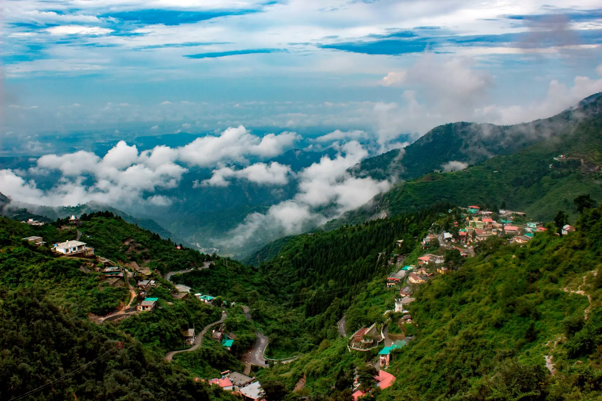
Uttarakhand Tourism places Nainital in the Kumaon Himalayas at around 2,000 m, surrounded by seven hills it names Ayarpata, Deopata, Handi-Bandi, Naina, Alma, Lariya-Kanta and Sher-ka-Danda. It was the summer capital of the United Provinces in the British era, and its villas, churches and schools date from then. Most sights lie within a few kilometres of the lake; the lakes and temples further out are day trips.

Naini Lake

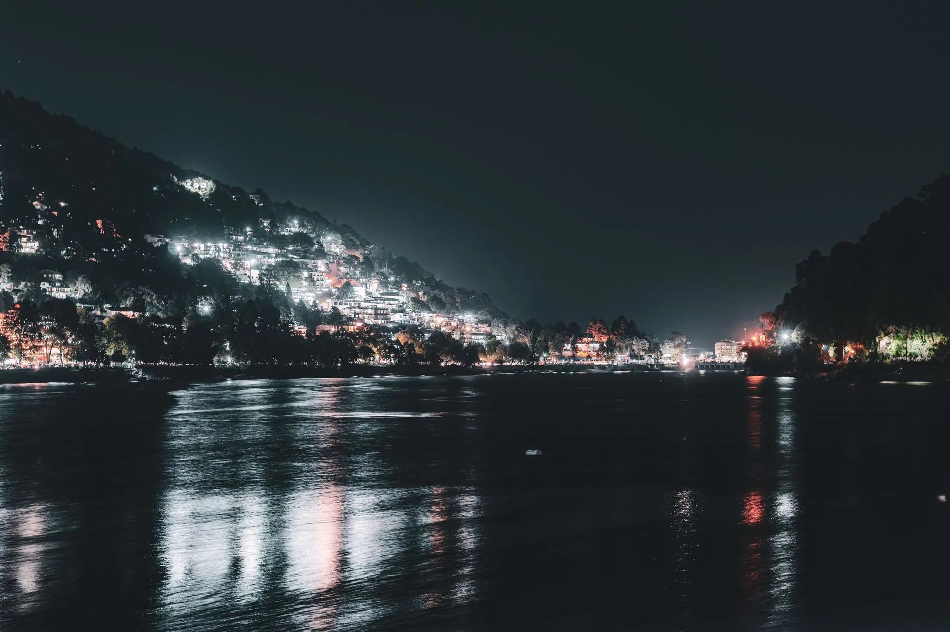
The district calls the lake the nucleus of Nainital's beauty: by day the seven hills and their cottages are reflected in it, and at night the lights of the shore. Rowing and paddle boats are available at both ends of the lake, with rates posted at prepaid booths on the shore. Mallital lies at the northern end and Tallital at the southern. According to mythology, the lake formed when the eyes of the goddess Sati fell here while Shiva carried her body, a story tied to the Naina Devi temple at its edge.

Naina Devi Temple

Uttarakhand Tourism describes the Naina Devi temple as one of the most revered temples in India, with the goddess Naina Devi as its presiding deity and her two eyes representing divinity. The state's pages place it on the Naina hill near Naini Lake and, elsewhere, at the edge of the lake, and say that many myths and legends are attached to it and that it draws devotees throughout the year. The same pages call Naina Peak, known locally as Cheena Peak, the highest point in Nainital; the climb to it is described below.

Mall Road

Uttarakhand Tourism says the British built the Mall Road to connect Mallital and Tallital. Its official name is Govind Ballabh Pant Marg, and it runs along the lake lined with restaurants, shops, banks, hotels and travel agents. The state's list of must-buys is handmade candles and pinewood artefacts. The district publishes traffic rules for it that restrict vehicles at set hours in May, June and October, light vehicles included in the evening. On the far side of the lake, the district says, Thandi Road is quieter, has the Pashan Devi temple and does not allow vehicles.

Snow View and the ropeway

Snow View is the most easily reached hilltop, 2.5 km from the town at about 2,270 m, and the district describes views of the snow-covered Himalayan peaks, with a temple, tea and snack stalls on the hill. A ropeway runs there from Mallital, and a one-way ride takes about three minutes. Uttarakhand Tourism says a large pair of binoculars is installed at the top for a closer look at the peaks. The district and the state's tourism pages give different timings and fares for the ropeway, so confirm both at the station on the day.

Tiffin Top (Dorothy's Seat)

Tiffin Top is a peak 4 km from the town at 2,292 m, on the Ayarpatta hill, with a view of the Himalayas and the surrounding country. Dorothy's Seat, beside it, is a memorial to an English painter, Dorothy Kellet, built by her husband after her death, and the district says Tiffin Top and Lands End can be covered at a stretch because the two spots are side by side. Uttarakhand Tourism notes that many tourists like to trek up.

Naina Peak (China Peak)

At 2,611 m, Naina Peak, also called China Peak, is the highest point of the town, 6 km away. The district says its view runs from Bandar Punch in the west to the Api and Nari peaks of Nepal in the east, with a bird's-eye view of the lake on the other side, and that ponies can be hired for the climb from Snow View or from Barapathhar. Uttarakhand Tourism describes the Naini Peak to Pangot walk as a two-day trek that starts at Mallital and passes Snow View.

Nainital Zoo

The Pt. Govind Ballabh Pant High Altitude Zoo stands at about 2,100 m on the Sher-ka-Danda hill. The district lists monkeys, Himalayan black bear, leopard, wolf, hill fox, ghoral, barking deer and sambar among the animals, and says the zoo is closed on Mondays, national holidays, Holi and Diwali. A zoo shuttle runs from the Nainital bus station. Uttarakhand Tourism describes it as one of the town's best-known family destinations.

St John in the Wilderness Church

Built in 1846, the church is one of the oldest buildings in Nainital, in the Neo-Gothic style and surrounded by deodar and pine. Uttarakhand Tourism records that the hunter and naturalist Jim Corbett was a regular worshipper. The state's tourism pages also list a Himalayan Museum, established under Kumaun University's Department of History in 1987 to conserve the historical and cultural identity of Uttarakhand, which is closed on Sundays and public holidays.

Bhimtal

Bhimtal is about 22 km from Nainital at 1,370 m. The district says its lake is larger than Naini Lake and that boats go to an island in the middle which has an aquarium, 91 m from the shore. A 17th-century temple complex, the Bhimeshwar temple, stands along the 40-foot dam. One road from Bhimtal leads on to Naukuchiatal and another runs 21 km to Kathgodam.

Sattal and Naukuchiatal

Sattal, about 23 km from Nainital at 1,370 m, is a cluster of lakes in oak forest; the district names Nal Damayanti, Panna or Garuda, and Ram, Laxman and Sita among them. Naukuchiatal, 26 km away at 1,220 m, is a deep lake with nine corners, 983 m long and 693 m wide according to the district, where rowing, paddling, yachting, angling and bird watching are all possible. Sattal is 12 km from Bhowali, and Naukuchiatal is 4 km on from Bhimtal.

Kainchi Dham

Kainchi Dham lies on the Nainital to Almora road, 17 km from Nainital and 9 km from Bhowali. The district calls it a modern pilgrim centre known for the ashram of Neem Karoli Maharaj, and Uttarakhand Tourism adds that the Hanuman temple and ashram were founded by him in 1962. It also says a cave near the temple is said to be where Neem Karoli Baba used to meditate and pray.

Pangot and Kilbury

Kilbury is a hamlet 12 km from Nainital, and Pangot is 15 km, both listed by Uttarakhand Tourism for forest walks, Himalayan views and bird watching. Pangot lies on the Naini Peak trek, and the state says it is blanketed in snow in winter. Kilbury is described as a quiet hamlet for a serene holiday, and Pangot as a haven for bird watchers with pleasant summers.

Things to do in Nainital

The state's tourism pages list boating on Naini Lake (rowing, paddling and yachting), the ropeway to Snow View, evening walks along the Mall Road, hiking to Naini Peak or the walk of around 6.7 km to Khurpatal, paragliding around Bhimtal and Kotabagh, hot-air ballooning at Sukhatal and golf at the Raj Bhavan course. The Aryabhatta Research Institute of Observational Sciences, an observatory on Manora Peak, is open to visitors. For guided departures and tours across the state, see our Uttarakhand tours and experiences and Uttarakhand tour packages pages.

Best time to visit Nainital

Uttarakhand Tourism calls Nainital an all-year destination with the best weather between March and June. It says the town receives heavy snowfall in winter, which makes Christmas and New Year popular. July and August are the wettest months in the state, with long-period averages of about 418 mm and 386 mm, according to the India Meteorological Department, so allow for rain if you travel then. The district's Mall Road traffic rules name May, June and October. Check the IMD forecast and road conditions before you go.

How to reach Nainital

  • By air: Pantnagar is the nearest airport, 70 km away by the district's count, with regular flights to Delhi. From Delhi's international airport, Uttarakhand Tourism adds, the remaining journey is about 300 km by road.
  • By train: Kathgodam, about 35 km away according to the district, is the last stop of the broad-gauge line, and the Ranikhet Express runs between Delhi and Kathgodam. Taxis and buses wait at Kathgodam and Haldwani, 40 km out. Our guide to booking Indian trains explains how visitors from abroad book.
  • By road: Nainital is on National Highway 87, with regular buses from Delhi, Agra, Dehradun, Haridwar, Lucknow, Kanpur and Bareilly and luxury coaches from Delhi. Uttarakhand Tourism gives the bus from Delhi's Kashmiri Gate as about seven hours. The district gives Almora 64 km, Ranikhet 62 km and Ramnagar, the gateway to Corbett, 65 km.

How many days in Nainital

One day is enough for the lake, the Mall Road, Snow View and Tiffin Top. Two days add the zoo, the Naina Devi temple, and either Bhimtal and Sattal or Kainchi Dham. A third day suits Pangot or Kilbury for birds, or the Naini Peak climb. Many travellers pair Nainital with Corbett, 65 km to Ramnagar by the district's count: see our Jim Corbett travel guide for the safari side. Mussoorie, in Dehradun district, is a separate hill-station journey; see our Mussoorie guide. The wider picture is in our Uttarakhand travel guide.

Getting around and tips

The bridge between Mallital and Tallital has a bus station and a taxi stand, which makes it the town's hub. A zoo shuttle runs from the bus station, ponies for Naina Peak can be hired from Snow View or Barapathhar, and the Mall Road, the lake and the ropeway station are within walking distance of one another, since the district puts the Mall Road about 200 m on foot from the station.

Why book with Experience My India

  • Government-approved operator

    Approved by the Ministry of Tourism, Government of India

  • 500+ vetted local guides

    35+ destination specialists plan every trip by hand.

  • Human help, every day

    Mon–Sun, 9:00 AM – 9:00 PM IST · +91 73022 65809

  • No payment until you approve

    You receive a written quote first; nothing is charged to start planning.

Frequently asked questions

What is Nainital known for?

Nainital is known for Naini Lake, a hill-station town set around it at about 2,000 m, and for the Mall Road, the ropeway to Snow View and viewpoints toward the Himalayas. It was the British summer capital of the United Provinces, and the Naina Devi temple at the lake is among its best-known sights. Bhimtal, Sattal and Kainchi Dham lie within about 25 km of the town.

How many days do you need in Nainital?

Two days cover the lake, the Mall Road, Snow View, Tiffin Top and either Bhimtal and Sattal or Kainchi Dham. One day covers the lake and Snow View only, while a third day allows Naina Peak, Pangot or Kilbury at a slower pace. Plan extra time if you add Corbett National Park, with Ramnagar 65 km away.

When is the best time to visit Nainital?

Uttarakhand Tourism says the weather is best between March and June, although Nainital is an all-year destination. Winter brings heavy snowfall, which makes Christmas and New Year popular. July and August are the wettest months in Uttarakhand, so expect rain then. The district's Mall Road traffic rules name May, June and October.

Can I combine Nainital with Jim Corbett?

Yes. The district gives Ramnagar, the gateway to Corbett National Park, as 65 km from Nainital, and Uttarakhand Tourism lists Corbett among the destinations near it. See our Jim Corbett guide for how safaris work.

How far is Nainital from Delhi?

About 300 km by road, according to Uttarakhand Tourism, which gives the bus from Delhi's Kashmiri Gate as roughly seven hours. The district's road table says 310 km. By train, take the Ranikhet Express to Kathgodam and continue by taxi or bus for about 35 km. Pantnagar airport, 70 km away, has flights to Delhi.

Where is the nearest railway station and airport to Nainital?

Kathgodam is the nearest major railway station, about 35 km away by the district's count, and Pantnagar is the nearest airport, about 70 km away. Haldwani, 40 km out, is the other railway terminal and bus hub. Taxis and buses run from Kathgodam and Haldwani to Nainital, and the district lists shared-seat taxis at the Haldwani taxi stand and at the Kathgodam and Lalkuan railway stations.

What is the Nainital ropeway?

It is a cable car between Mallital, near the Mall Road, and Snow View, a hilltop at about 2,270 m. A one-way ride takes about three minutes, and the district says two trolleys serve the line. Timings and fares are posted at the station and the official pages differ, so confirm them on the day before you plan around the ropeway.

Which places near Nainital make a good day trip?

From the district's distances: Kilbury 12 km, Pangot 15 km, Kainchi Dham 17 km, Bhimtal 22 km, Sattal 23 km and Naukuchiatal 26 km, with Mukteshwar 51 km away. Bhimtal, Sattal and Naukuchiatal can be linked into one loop by road. Kainchi Dham lies on the Almora road, 9 km beyond Bhowali.

From the journal: Nainital

Customer reviews

Experience My India is rated 4.3 on Tripadvisor. We publish guest reviews after each trip.

Read our reviews

Plan a trip

Tailor-made quote from a specialist